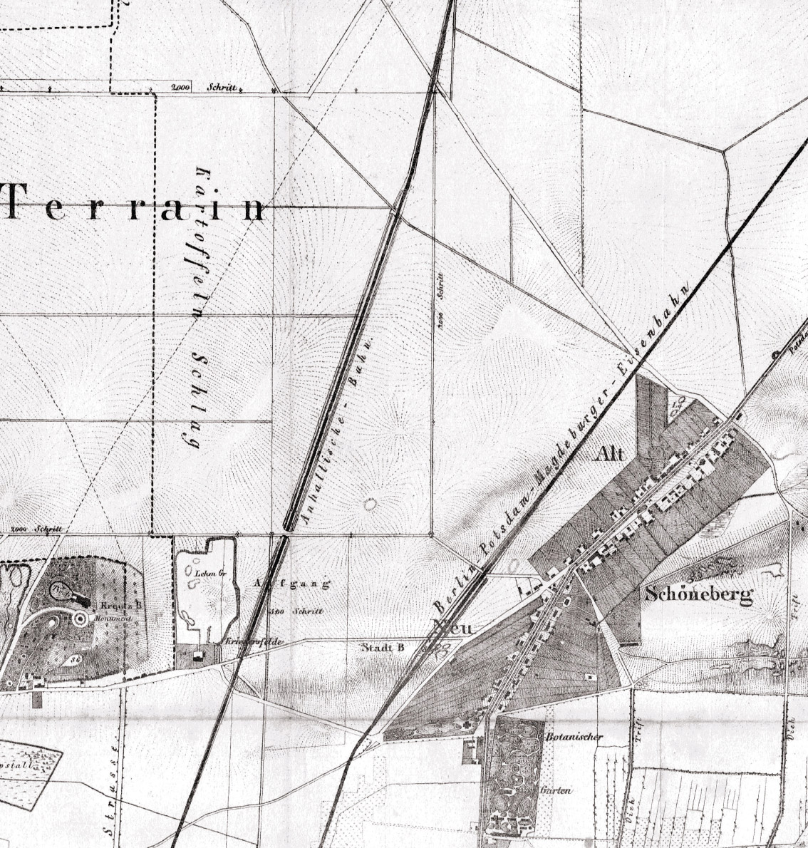
Overview map of the military training grounds near Hallesches Tor, 1841
This map is not oriented to the north, but rather to the south. This was often the case far into the 19th century.
Bezirksamt Tempelhof-Schöneberg, Fachbereich Vermessung und Geoinformation
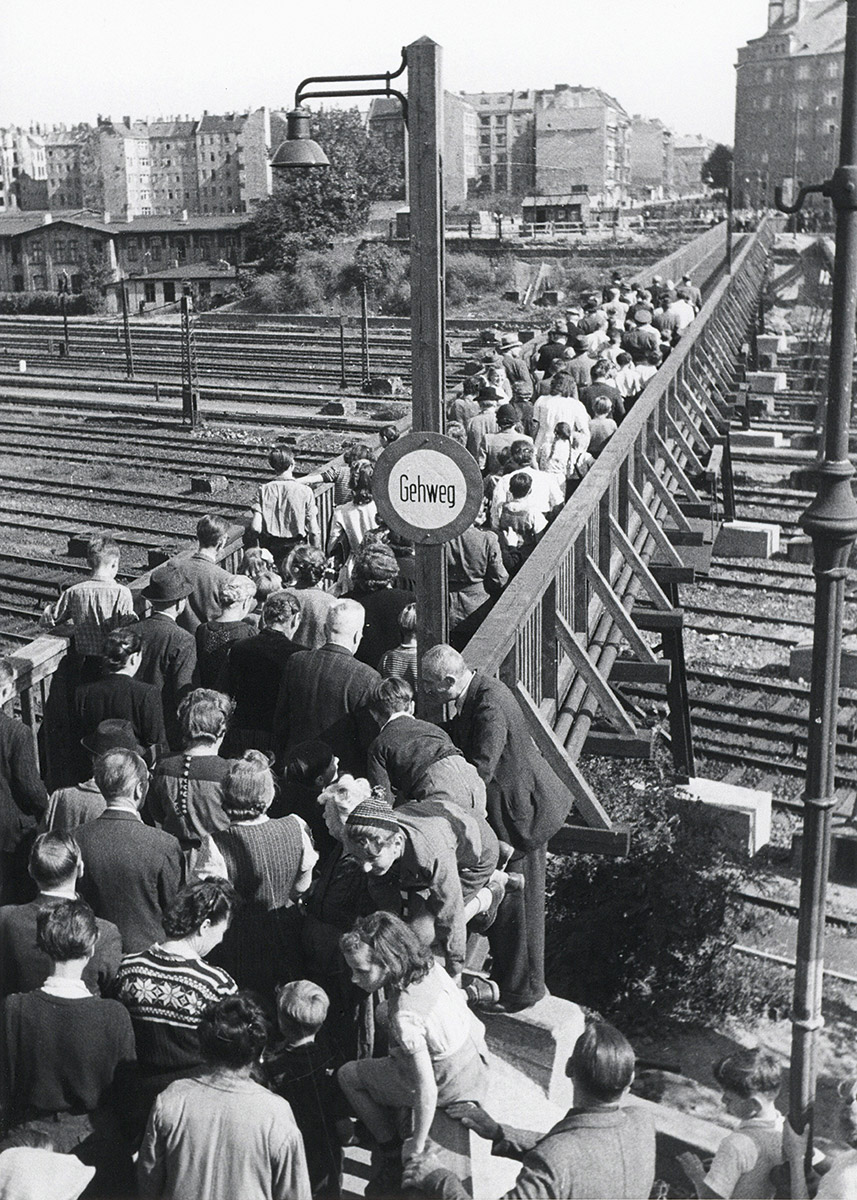
The opening of the temporary footbridge as a replacement for the Kolonnenbrücke, which burnt down in 1943, September 1950
Photo Wilhelm Rissleben, Landesarchiv Berlin
The Anhalter Bahn
In the year 1841 the Anhalter Bahn, a private railway line, was opened. It ran south from the station Anhalter Bahnhof in the Berlin municipal area, where it was connected with the Sächsische Eisenbahn line. The Anhalter Bahn touched on the Schöneberg meadowlands in the east. When the circular Ringbahn was later completed in 1870, the area was entirely encircled by railway tracks, thus becoming an island: the “Insel”.
The routing of the Anhalter Bahn to the south of the former Berlin city border was difficult because of the military training grounds, which were not supposed to be intersected. After prolonged negotiations between the railway management and the military treasury, it was decided that as a trade-off a bridge had to be built over the tracks at the spot that was then still called Colonnenweg.
Kolonnenbrücke
The first Kolonnenbrücke was a massive arched bridge. It was torn down in 1874 when the Berlin-Dresden railway was being built, which ran along the present-day Lichtenrader S-Bahn line alongside the Anhalter Bahn railway. It was replaced by a 100-metre wooden bridge. Despite the busy traffic the wooden bridge existed until it was destroyed in the Second World War in 1943.
The Kolonnenbrücke was rebuilt in the 1950s. A temporary footbridge known as the “Kolonnensteig”, or footpath, was built for pedestrians and bicycle riders to cross the many train tracks.